Find Picnic Tables on Open Street Maps
Over the last year, I've been doing a lot of outdoor eating. It's made me appreciate all the public picnic tables that are out there. The problem is, they're hard to find. If you're not familiar with an area, you have to find a park and hope there's a good picnic table there. There's not a good way to search for picnic tables. Or is there?
And it turns out there is a way to search for picnic tables! Here's how you do it. If you'd like to understand more about how this work, scroll down to the bottom. If not here's the instructions!
Go to overpass-turbo.eu
Scroll and zoom the map to the specific area you want to search.
Enter this query in the window on the left and click "Run"...
[out:json][timeout:25];
(
// query...
node["leisure"="picnic_table"]({{bbox}});
node["tourism"="picnic_site"]({{bbox}});
relation["leisure"="picnic_table"]({{bbox}});
relation["tourism"="picnic_site"]({{bbox}});
);
// print results
out body;
>;
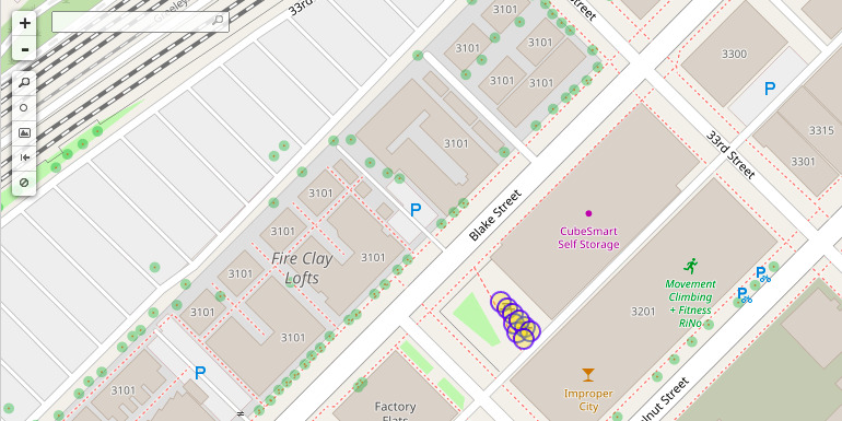
out skel qt;And the map will circle the picnic table locations!
So how does this work? There's this website called OpenStreetMap where anyone can contribute GPS information about a location. It's like Google Maps but it's build by contributes like me and you and has details about picnic tables and bike routes and benches.
There are thousands of people contributing to the map everyday, including the locations of picnic tables. When someone contributes, they label a "node" (a location on the map) with a set of tags. For example, a location can be tagged with any of these tags to indicate there is a picnic table there...
You could even narrow your search to find picnic tables that are lit by searching with the lit=yes tag.
If you'd like to learn more or contribute to the map, check out the Beginner's Guide on OpenStreetMap.
Thanks to EdLoach for answering this similar question which helped me to discover this method.